Our Products


BRINGING DATA TO LIFE WITH TRIMBLE SITEVISION.

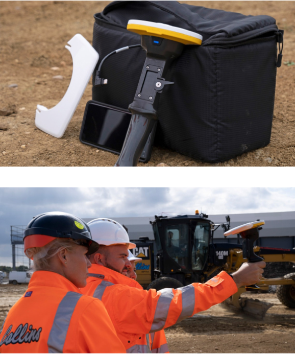
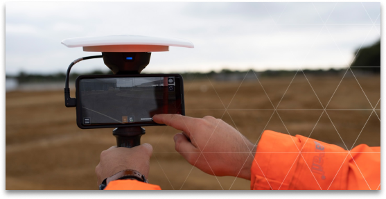
Trimble® SiteVision™ is a user-friendly, hand-held outdoor augmented reality system. It brings spatial data to life so you can easily visualise, explore and understand complex information.

GPS gadgets on display

SITEVISION

OUTDOOR AUGMENTED REALITY.

Providing real-world context to designs enables users to quickly communicate complicated plans and drawings, confirm designs and precisely identify where hidden assets are to minimise costly errors and safety related incidents.
SiteVision is powered by Trimble’s Catalyst softGNSS receiver, combined with Google ARCore technology, with user connectivity through Trimble Connect, a cloud-based collaboration platform.

SITEVISION IS DESIGNED TO IMPROVE A VARIETY OF WORKFLOWS INCLUDING:

  • On-site measurements – quickly calculate points, lines, cut/fill values.
  • Validate data – on-site.
  • Utilise sub surface mapping information – for underground infrastructure and utilities.
  • Efficient inspections – to quickly determine site productivity.
  • Visualise work – planned and completed.
  • Finished grade checking – against design elevations and tolerances.
  • Monitoring and quality control – for earthworks and paving operations.


DOWNLOAD:
Datasheet
Spec Sheet

road paving machine in action

TALK TO SITECH TODAY

to find the best solutions and training for you


This website is using cookies

Cookies remember you so that we can provide you a better service. By using this website or closing this message, you are agreeing to our Cookie Policy. If you do not wish to allow cookies, please disable them in your browser settings. Click the continue button to stop this message from being displayed again (note a cookie will be required to remember your decision).

Cookie Policy